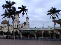
 For the last couple of days, we’ve been tracing the course of our river upstream from where it joins it’s cousin, the Papaloapan, near to the town of Cosamaloapan. It’s not a pleasant place and the presence of more than half a dozen heavily armed state security policeman in the town square even at lunch time, indicated a lively nature and a dangerous place for gringos laden with expensive technology to be come nightfall. But in very different times, this is where our French naturalist originally departed from and subsequently spent 10 or 11 days we estimate, paddling upstream looking for the source.
 Today this is principally sugar cane country, with some small scale ranching and the occasional pineapple plantation for good measure. The endless sea of green, anything up to twice our height over generally level ground, presented us with considerable problems. It makes access to the river very difficult and it's almost impossible to see even when relatively close, let alone from any kind of distance. But with the expedition vehicle, we headed to where any kind of roadway crossed it or there was a village on it's banks. This too was not without it's own difficulties as quite naturally, any strangers to these communities attract attention, and three gringos in a Beetle is a total phenomenon. In one village, having cruised around several times somewhat lost, our progress was suddenly halted by the local young guns in a pick up truck, curious about our incursion on to their turf although it all ended quite amicably.
 We eventually worked our way upstream and as the terrain changed to rolling hills, it was clear to us that our French naturalist had genuinely been here and that his story wasn't a work of fiction written from the comfort of an arm chair somewhere. Although significantly altered and very much more populated than it was 145 years ago, the geography itself is inherently exactly the same although we believe the water table is considerably lower now, possibly from climate change or the consequence of intensive agriculture. The wild life is still as prolific, large buzzards are always circling overhead and white ibises stand out vividly against the wide palette of greens. Thankfully, from the perspective of our personal safety that is, the alligators that once infested this area have all gone, no doubt turned into shoes and handbags long ago !
 On our last day in the area, we set ourselves the target of reaching the point where the river reached the mountains and from where our naturalist was compelled to go onwards on foot. From the nearest point of access, with the mountains still several miles away, we set off into the thick vegetation, with the intention of forcing a way through and holding tight to the right bank. But it proved to be almost impossible, and after 40 minutes and less than half a mile of progress that saw us dripping in sweat, a new plan was required. Realising we'd be exhausted long before we'd reached even half way there, we decided to move back into the cane fields and use the tracks between them to head in what we approximated was the right direction. We made contact with the river a few more times but kept heading towards the mountains that by now drew ever closer. As we forged onwards, there was a constant buzz from the countless millions of mosquitoes that hovered above the cane and the chatter of birds alarmed by our approach.
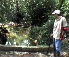
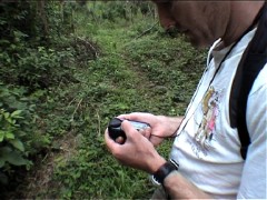
 And eventually we made it, although by now the river itself was nowhere in sight. So we moved along the base of the escarpment, knowing that eventually, we should at some point intersect it. After a couple more miles, slightly to our surprise although probably much more to his, we came across a young man squatting by the side of the path, machete across his lap. With our limited Spanish, we enquired after the river and he kept pointing in what we calculated was completely the wrong direction and presumed he thought we were looking for the way back out. No sooner had we said our thanks and continued along the path, than we crossed a river, by now quite narrow. Beyond it we could see a village and as we stopped on the small bridge to take some photos and take a Global Positioning Satellite (GPS) fix, the young man appeared again, joining us but standing in front of the path beside the river that led up the hill.
As we began walking through the village, a pick up rolled along behind us and gestured for us to climb aboard and as we were by now quite tired, we were happy to accept the lift out of town and back to the main road, several miles away. As we drove off, although happy to have achieved our objective, it felt very frustrating to have neither the time or the energy to carry on towards the Dead City.
 But after a hot shower and a couple drinks that evening, we began to reflect on our adventure. Sure, it would have been great to have gone as far as our French naturalist and been able to say definitively, whether or not it existed. But realistically, the chances of that were always on a par with sticking your hand into the haystack and pulling out the needle first time around. What we have achieved though, is some very accurate GPS data and once back home, we'll use this to obtain satellite photography to get an idea of what lies beyond. What we couldn't help wondering though, was that guy standing in front of the path up into the hills just accidental ? Which was then followed by the mysterious arrival of an unsolicited escort out of town, maybe it wasn't a coincidence ? If our calculations are right, then it's only 2 days walk into those mountains to the Dead City and just maybe, that's something they didn't want us to see.
But we've not given up and just as soon as we can, well be back !

 For the last couple of days, we’ve been tracing the course of our river upstream from where it joins it’s cousin, the Papaloapan, near to the town of Cosamaloapan. It’s not a pleasant place and the presence of more than half a dozen heavily armed state security policeman in the town square even at lunch time, indicated a lively nature and a dangerous place for gringos laden with expensive technology to be come nightfall. But in very different times, this is where our French naturalist originally departed from and subsequently spent 10 or 11 days we estimate, paddling upstream looking for the source.
 And eventually we made it, although by now the river itself was nowhere in sight. So we moved along the base of the escarpment, knowing that eventually, we should at some point intersect it. After a couple more miles, slightly to our surprise although probably much more to his, we came across a young man squatting by the side of the path, machete across his lap. With our limited Spanish, we enquired after the river and he kept pointing in what we calculated was completely the wrong direction and presumed he thought we were looking for the way back out. No sooner had we said our thanks and continued along the path, than we crossed a river, by now quite narrow. Beyond it we could see a village and as we stopped on the small bridge to take some photos and take a Global Positioning Satellite (GPS) fix, the young man appeared again, joining us but standing in front of the path beside the river that led up the hill.
